U.S. Under Threat: Arthur Brings Historic Rainfall and Deadly Risks

Posted on 06/19/26 at 14:43
- Tropical Storm Arthur Threatens the South
- Deadly Flooding Warning Issued
- Texas and Louisiana Under Watch
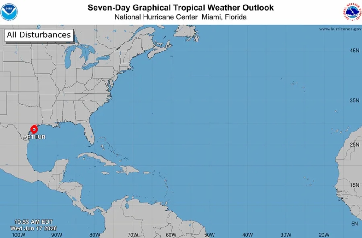
Tropical Storm Arthur became the first named storm of the Atlantic hurricane season this Wednesday and is threatening the southern United States with heavy rain, potentially life-threatening flash flooding, and strong winds.
Why it matters: The system is mainly affecting Texas and Louisiana, although its effects could extend to several states in the southeastern part of the country.
The National Hurricane Center, or NHC, reported that Arthur formed this Wednesday in the Gulf of Mexico.
According to the agency’s latest advisory, the center of the storm was located about 35 kilometers, or 20 miles, north-northwest of Matagorda, Texas.
Tropical Storm Arthur Threatens Texas and Louisiana
☔️ Tropical Storm Arthur has 18 million people on alert from Texas to Georgia.
https://t.co/Hi7v7UKJik— Noticias Telemundo (@TelemundoNews) June 18, 2026
It was also located about 310 kilometers, or 195 miles, southwest of Lake Charles, Louisiana, according to EFE.
Arthur had maximum sustained winds of 75 kilometers per hour, or 45 miles per hour.
It was also moving north-northeast at a speed of 11 kilometers per hour, or 7 miles per hour.
The NHC said tropical-storm-force winds extend up to 280 kilometers, or 175 miles, from the system’s center.
Authorities are maintaining tropical storm warnings between Sargent, Texas, and Morgan City, Louisiana.
Heavy Rain and Flooding Worry Authorities
Meteorologists warned that the main risk associated with Arthur will be heavy rainfall.
Rainfall totals of between 12.5 and 25 centimeters, or 5 to 10 inches, are expected in the affected areas.
In isolated locations, some places could receive up to 50 centimeters, or 20 inches, of rain.
YOU MAY BE INTERESTED IN: Emergency in the Southern U.S.: Rescues and Roads Destroyed by Flash Flooding
These conditions increase the risk of potentially life-threatening flash flooding.
In addition to Texas and Louisiana, the storm’s effects could be felt in Mississippi, Alabama, and northwestern Florida.
The NHC also warned about storm surge, dangerous surf, and rip currents.
Authorities are also monitoring the possible formation of isolated tornadoes in some areas affected by the system.
The combination of heavy rain, strong winds, and dangerous marine conditions is keeping much of the region under watch.
The First Tropical Storm of an Active Season
The National Hurricane Center expects tropical storm Arthur to continue moving inland across southeastern Texas over the next few hours.
Forecasts indicate that the system will begin to gradually weaken.
It could even dissipate between Wednesday night and early Thursday morning.
Arthur is the first named storm of the current Atlantic hurricane season.
The season officially began on June 1 and will run through November 30.
In May, the National Oceanic and Atmospheric Administration, or NOAA, presented its forecast for this year.
The agency estimated the formation of up to 14 named storms in the Atlantic.
Of that total, up to six could reach hurricane strength.
The projection is below the recent historical average.
It also comes after a 2025 season in which 13 cyclones were recorded.
According to NOAA, no hurricane made landfall in the United States during 2025, something that had not happened in a decade.


