NOAA Confirms Formation of El Niño in the Tropical Pacific, Putting the United States Under Pressure

Posted on 06/15/26 at 12:27
- NOAA Confirms El Niño
- Prolonged Heat Expected
- Climate Risks Increase
NOAA issued an official advisory Thursday on the formation of El Niño after detecting conditions that meet the criteria needed to declare the phenomenon.
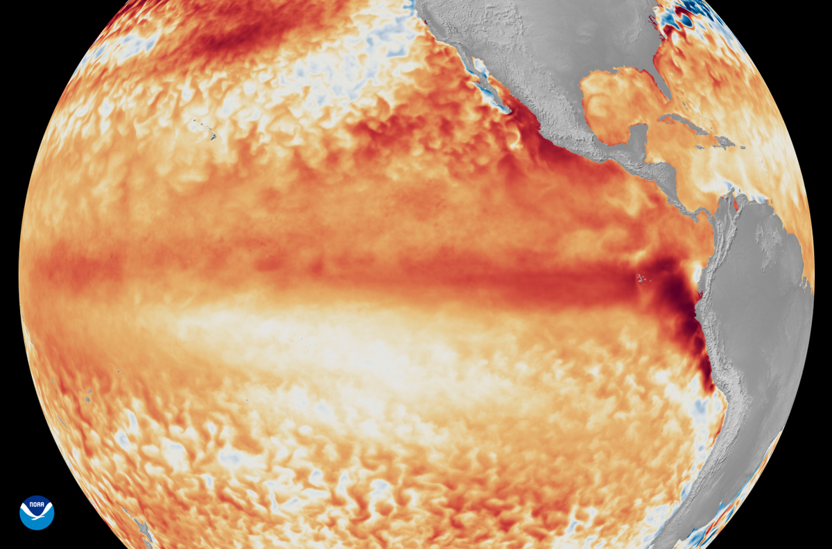
The weather agency explained that El Niño forms when temperatures in the equatorial Pacific remain at least 0.5 degrees Celsius above average for several consecutive months.
According to the latest projections, the phenomenon could move from moderate to strong intensity during the fall.
El Niño Strengthens in the Pacific and Will Influence Climate
⚠️👀 The chances of a very strong El Niño event are increasing
The ENSO intensity probability chart issued by NOAA shows an extraordinarily strong signal of El Niño development and strengthening over the coming months… pic.twitter.com/I2gWloSoab
— Dayron Pérez (@dayronperezwx) June 11, 2026
NOAA estimated a 63% probability that sea surface temperatures will exceed 2 degrees Celsius above normal in the Pacific region where the phenomenon develops.
The agency described the event as potentially “very strong” and anticipated a prolonged period of above-average temperatures.
El Niño is characterized by warmer-than-normal waters in the Pacific Ocean and stronger westerly winds.
These conditions generate an increase in vertical wind shear, a factor that can modify weather patterns in different regions.
Changes in Storms, Hurricanes, and Flooding
The U.S. National Oceanic and Atmospheric Administration, or NOAA, reports that the El Niño weather phenomenon has formed in the tropical Pacific, with the expectation that it will be “very strong.” https://t.co/ZZrXhKmgjU
— EFE Noticias (@EFEnoticias) June 11, 2026
NOAA said that for countries located within El Niño’s area of influence, such as the United States, conditions usually translate into a warmer and drier winter than usual.
However, more storms are also expected in the southern part of the country, according to EFE.
Changes in wind patterns associated with the phenomenon also influence cyclonic activity.
According to the agency, there is a greater possibility of tropical cyclones in the Pacific Ocean.
YOU MAY BE INTERESTED IN: Tropical Storm Cristina Threatens Central America: Heavy Rain and Flooding Risk Raise Alerts
At the same time, the conditions generated by El Niño reduce the likelihood of hurricanes in the Atlantic.
In May, NOAA forecast an Atlantic season below the historical average.
The outlook includes 14 named cyclones, including six hurricanes.
For the Pacific, however, cyclonic activity will be above the historical average.
The projection includes between 15 and 22 named storms during the season.
In addition, the agency warned about a greater risk of flooding caused by surf.
The U.S. West Coast is among the areas that could be most affected.
The Phenomenon Coincides With a Heat Wave in the United States
The arrival of El Niño comes as the United States faces the early arrival of the first heat wave of the summer.
The National Weather Service, or NWS, forecast above-average temperatures across much of the country.
In some areas, thermometers could exceed 37 degrees Celsius, equivalent to 100 degrees Fahrenheit.
NOAA also warned about other possible effects related to the phenomenon.
These include changes in fish migration patterns and the appearance of harmful algae.
The formation of El Niño also occurs in a context of persistent dry conditions across much of U.S. territory.
In March, NOAA had anticipated that the drought affecting more than half the country would continue through spring.
The agency also projected temperatures above the historical average from April through June across almost all of the United States.