Storm System Threatens Millions: Giant Hail and Tornado Risk From Texas to New York

Posted on 03/07/26 at 13:28
- Storm system with hail in the US
- Slight tornado risk
- Alerts across several states
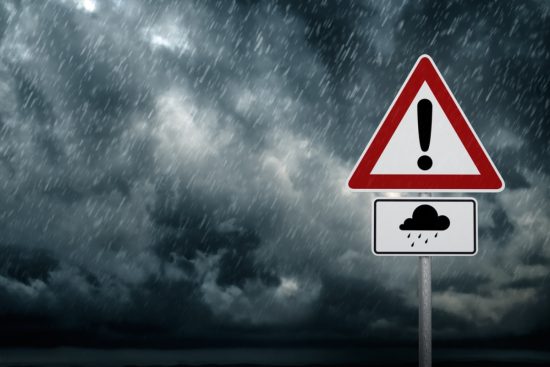
A powerful low-pressure system is putting tens of millions of people under threat across the central and northeastern United States.
The phenomenon, moving from the Great Lakes toward the East, is pushing warm and unstable air ahead of the arrival of an intense cold front.
This combination is generating a new round of severe storms stretching from Texas to New York.
Meteorological authorities warn of destructive winds, large hail, and the possibility of isolated tornadoes as this US severe storm system develops.
Cold front triggers intense storms in the United States

The cold front, originating in the eastern Great Lakes region, is organizing squall lines and clusters of thunderstorms.
These storm bands are moving from the eastern Great Lakes, crossing the Ohio Valley and reaching the south-central region.
You may also be interested in: Expert Who Predicted Conflict With Iran Issues New Warning About the US
In the Deep South, activity was more intense during the morning, with a tendency to weaken later in the afternoon.
However, in parts of the upper Ohio Valley the highest tornado risk remains, along with damaging wind gusts and large hail.
Texas under threat of supercells
At the southern end of the US severe storm system, especially in Texas, short-lived supercells could develop.
These isolated storms would have the potential to produce the largest hail impacts of the event.
Some hailstones could reach or even exceed the size of a tennis ball within the most intense storm cores.
Although the probability of tornadoes is lower in this region, meteorologists do not rule out the formation of one or two brief funnels.
Heavy rain and active alerts
In addition to the risk from wind and hail, rainfall totals of 1 to 2 inches (2.5 to 5 cm) are expected over the weekend.
In localized areas, totals could exceed 3 inches (about 7.6 cm).
A severe storm watch is currently in effect in parts of Arkansas, Mississippi, and Tennessee.
Cities such as Little Rock, Pine Bluff, Greenville, and Jackson remain under monitoring due to the possibility of dangerous weather conditions.
Areas with the highest level of risk
The Storm Prediction Center identified two main areas with a slight risk of severe weather, equivalent to 2 out of 5 on its scale.
The first stretches from eastern Kentucky to western New York, where tornado potential is higher.
The second extends from west-central Alabama to eastern Texas, where the threat of large hail is greater.
Among the cities within these risk areas are Houston, Dallas, San Antonio, Shreveport, Jackson, Charleston, Cleveland, Buffalo, and Pittsburgh.
Days earlier, this same system produced severe storms with tornadoes, including a long-track destructive tornado in southwestern Michigan.
Conditions favorable for severe weather in the US
Authorities emphasize the importance of distinguishing between a weather watch and a warning in order to act quickly.
A watch indicates conditions favorable for severe weather, while a warning means the danger is imminent.
Experts recommend staying informed, preparing an emergency kit, and remembering a basic safety rule: “When thunder roars, go indoors!”, according to Weatherbug.